
world says that the footprint mark is the left foot of the Buddha, left behind as he strode away,
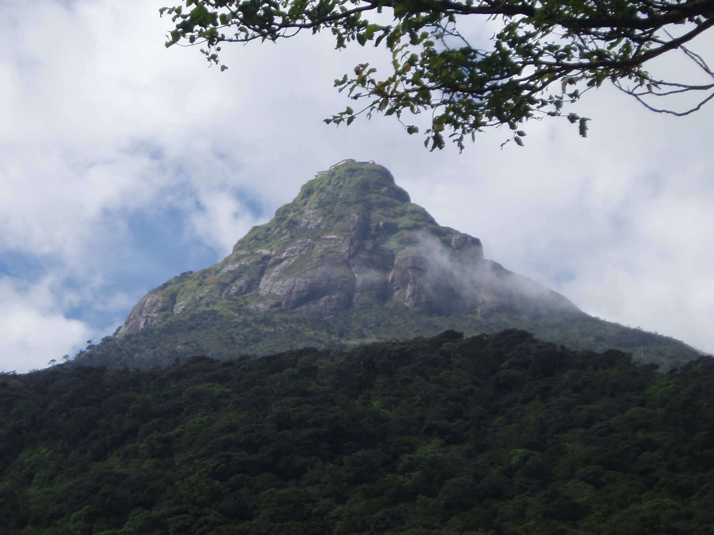
Though not the highest mountain of Sri Lanka, the striking pyramid of Adam's Peak (7,360 ft) is certainly the most remarkable. A depression in the rocky summit resembles a huge footprint, which has been venerated as a sacred sigh from remote antiquity. This was identified by Buddhists as the Buddha's footprint, by Hindus as that of Shiva, and by Muslims as Adam's. Later the Portuguese attributed it to St. Thomas the Apostle.
The Mahawamsa tells how the sacred footprint was imprinted by the departing Buddha on his third visit to Lanka, but the site did not become an object of regular Buddhist pilgrimage until the Polonnaruwa period, when Vijayabahu I built resting houses for pilgrims and King Nissankamalla himself, in the year 1201, climbed to the top and worshipped the spot.
 Trails
Access to the mountain is possible by 6 trails (Ratnapura-Palabaddala, Hatton-Nallathanni, Kuruwita-Erathna, Murraywatte, Mookuwatte & Malimboda). Out of these the Nallathanni & Palabaddala routes are the most popular. Kuruwita-Erathna road is somewhat popular as well. The other 3 roads are almost obscure. It joins the Palabaddala road midway through the ascent. Buses connect the final nodes of Nallanthanni to Hatton, Palabaddala to Ratnapura & Erathna to Kuruwita. There after it's a difficult journey through the forest on foot. Most of the pilgrims use Hatton route as the journey on foot can be reduced by more than five kilometers even though the slope of this route is much greater than other routes.
http://en.wikipedia.org/wiki/Adam%27s_Peak
Geography
 The mountain is located in the southern reaches of the Central Highlands, in the Ratnapura district of the Sabaragamuwa Province - lying about 40 km northeast of the city of Ratnapura. The surrounding region is largely forested hills, with no mountain of comparable size nearby. The region along the mountain is a wildlife reserve housing many species varying from elephants to leopards, and including many endemic species.

Sri Pada: Myth, Legend and Geography
The physical features of a land are often spoken of first, by a foreign visitor. Physical descriptions compare it to a pearl and a teardrop. Lying at the southern point of India its pendant shape appears like a drop of water as it falls. South of it there is nothing but the Antarctic. It is on the major sea route between West and East Asia and therefore was a trading station for the Arabs and a trading station and a colony for the Portuguese, the Dutch and the British. The Arabian Nights has possibly the first reference to it.

Categories:
lanka


